Hatfield Consultants

  • About
    • At A Glance
    • Our Leaders
    • Our History
    • Corporate Social Responsibility
    • Quality Management
    • Health & Safety
    • Environmental Policy
    • Indigenous Relations
    • Regions
      • Canada
      • Indonesia
      • Africa
  • Services
    • Water
      • Fish & Fish Habitat
      • Effects Monitoring & Ecotoxicology
      • Hydrology
      • Hydrogeology
      • Marine Ecology
      • Marine & Coastal Infrastructure
      • Regulatory Permitting
    • Land
      • Infrastructure Development
      • Vegetation & Wetlands
      • Forestry
      • Wildlife
      • Regulatory Permitting
    • People
      • Social Science
      • Engagement & Consultation
      • Knowledge Management
      • Human Centered Design
    • Technology
      • GIS & Mapping
      • Remote Sensing
      • Data & Information Management
      • Data Analytics
  • Sectors
    • Marine
    • Forestry
    • Infrastructure
    • International Development
    • Mining & Exploration
    • Oil & Gas
    • Pulp & Paper
    • Renewable Energy
  • Projects
  • News
  • Careers
    • Why Work at Hatfield?
    • Current Careers
    • Call for Consultants
  • Contact

Hatfield hosts geomatics seminar in Fort McMurray

You are here: Home / News / Hatfield hosts geomatics seminar in Fort McMurray

Hatfield hosts geomatics seminar in Fort McMurray

Feb 10, 2010

On March 10, Hatfield will be holding a seminar on Remote Sensing and GIS Applications in the Oil Sands Region. The goal of the seminar is to provide information about remote sensing and geomatics applications in support of natural resource management.

The seminar will be held on March 10th at the Syncrude Sport & Wellness Centre in Fort McMurray from 4:00 – 6:00 PM. The seminar will followed by a wine tasting led by Hatfield’s Karl Kliparchuk, Wine & Spirit Education Trust (WSET) certified.
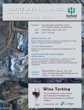
Invitation flyer

The seminar topics include the following:

Remote Sensing 101

Basics of Remote Sensing including the cost/benefit of using satellite imagery over other technologies

GIS/CAD Integration

Benefits and opportunities for sharing and integrating GIS and CAD data

Natural Resource Management Applications

Remote sensing and GIS applications in support of natural resource management, including vegetation mapping, disturbance mapping, compliance monitoring and stakeholder engagement

How To Register

To register for the seminar, please RSVP by February 15th, 2010.

Email: GeomaticsSeminar@hatfieldgroup.com

Phone: +1 (780) 743-4290

Hatfield uses the latest geographic information, remote-sensing, and web-development technologies to implement innovative, appropriate, and user-driven solutions and products for environmental applications around the world. Our geographic information system (GIS) and remote-sensing (RS) products and services complement our traditional environmental assessment and monitoring services.

For more information, please contact us:

Grant Bruce
President
HATFIELD CONSULTANTS PARTNERSHIP

E-mail: hcp@hatfieldgroup.com
Tel.: +1 604 926 3261
Toll-Free: 1 866 926 3261

Hatfield hosts geomatics seminar in Fort McMurray

February 10, 2010 by

Interested in joining our innovative team?

Career Opportunities
  • Home
  • About
  • Projects
  • News
  • Careers
  • Contact
  • Agent Orange

Sectors

  • Marine
  • Forestry
  • Infrastructure
  • International Development
  • Mining & Exploration
  • Oil & Gas
  • Pulp & Paper
  • Renewable Energy

Services

  • WATER
  • Fish & Fish Habitat
  • Effects Monitoring & Ecotoxicology
  • Hydrology
  • Hydrogeology
  • Marine Ecology
  • Marine & Coastal Infrastructure
  • Regulatory Permitting
  • LAND
  • Infrastructure Development
  • Vegetation & Wetlands
  • Forestry
  • Wildlife
  • Regulatory Permitting
  • PEOPLE
  • Social Science
  • Engagement & Consultation
  • Knowledge Management
  • Human Centered Design
  • TECHNOLOGY
  • GIS & Mapping
  • Remote Sensing
  • Data & Information Management
  • Data Analytics
Copyright © 2020 Hatfield Consultants
  • Terms & Conditions
  • Privacy Policy
  • About
    ▼
    • At A Glance
    • Our Leaders
    • Our History
    • Corporate Social Responsibility
    • Quality Management
    • Health & Safety
    • Environmental Policy
    • Indigenous Relations
    • Regions
      ▼
      • Canada
      • Indonesia
      • Africa
  • Services
    ▼
    • Water
      ▼
      • Fish & Fish Habitat
      • Effects Monitoring & Ecotoxicology
      • Hydrology
      • Hydrogeology
      • Marine Ecology
      • Marine & Coastal Infrastructure
      • Regulatory Permitting
    • Land
      ▼
      • Infrastructure Development
      • Vegetation & Wetlands
      • Forestry
      • Wildlife
      • Regulatory Permitting
    • People
      ▼
      • Social Science
      • Engagement & Consultation
      • Knowledge Management
      • Human Centered Design
    • Technology
      ▼
      • GIS & Mapping
      • Remote Sensing
      • Data & Information Management
      • Data Analytics
  • Sectors
    ▼
    • Marine
    • Forestry
    • Infrastructure
    • International Development
    • Mining & Exploration
    • Oil & Gas
    • Pulp & Paper
    • Renewable Energy
  • Projects
  • News
  • Careers
    ▼
    • Why Work at Hatfield?
    • Current Careers
    • Call for Consultants
  • Contact