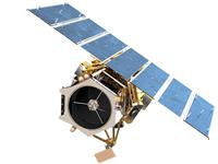
GeoEye-1 imagery now available
Feb 17, 2009
Hatfield announces that as an official GeoEye Channel Partner, it is now selling the world’s highest-resolution, commercial, color satellite imagery.

GeoEye Channel Partners consist of businesses and organizations with a long history of expertise in the geospatial world, remote sensing and extensive domain experience in a variety of disciplines. For more details, please visit: http://www.geoeye.com/CorpSite/products/channel-partners/
GeoEye-1 imagery products and solutions are now commercially available in half-, one-, two- and four-meter ground resolutions. Imagery products are available in color and black & white. Color imagery comprises four bands: blue, green, red and near-infrared. These imaging options can support a wide range of applications, including mapping, spatial analysis, cartography and high accuracy visualization for a variety of sectors including: Environment, Forestry, Engineering, Mining, and Oil and Gas.
Bill Schuster, chief operating officer for GeoEye, said, “We established extremely exacting requirements for GeoEye-1 and meeting them proved to be very technically challenging—particularly in the calibration phase. Additional improvements can still be made, but we have now succeeded in attaining our performance objectives. The combination of resolution, clarity, color and accuracy make it the best satellite imagery on the market.”
Hatfield Consultants provides clients with a range of Geographic Information System (GIS) and Remote Sensing (RS) products and services that complement traditional environmental assessment and monitoring services. Hatfield’s experienced GIS professionals are familiar with a wide range of satellite data products and use the latest digital image processing and GIS software packages.
For more information, please contact us:
Dr. Andy Dean
Senior Geomatics Specialist and Partner
HATFIELD CONSULTANTS PARTNERSHIP
E-mail: hcp@hatfieldgroup.com
Tel.: +1 604 926 3261
Toll-Free: 1 866 926 3261